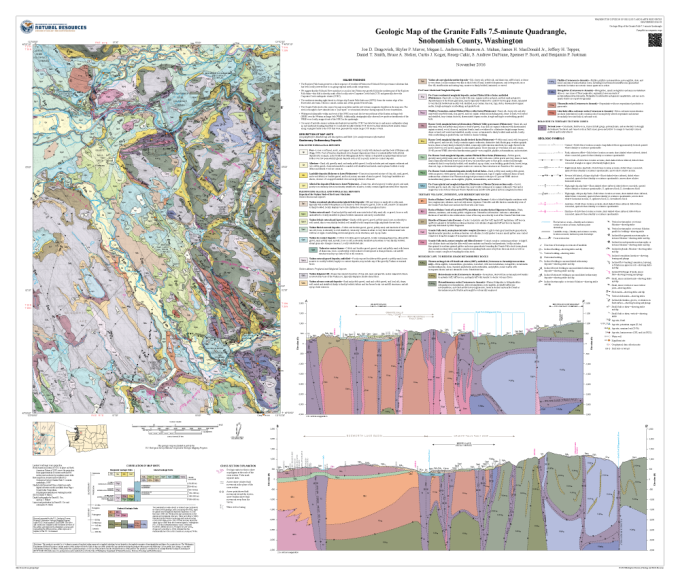
Geologic Map of the Granite Falls 7.5-minute Quadrangle, Snohomish County, Washington
This publication is the result of our yearly 1:24,000-scale mapping efforts throughout the state and provide a detailed level of geologic mapping. Efforts are on-going to completely map the state at this scale.
Suggested citation:
Dragovich, J. D.; Mavor, S. P.; Anderson, M. L.; Mahan, S. A.; MacDonald, J. H., Jr.; Tepper, J. H.; Smith, D. T.; Stoker, B. A.; Koger, C. J.; Cakir, Recep; DuFrane, S. A.; Scott, S. P.; Justman, B. J., 2016, Geologic map of the Granite Falls 7.5-minute quadrangle, Snohomish County, Washington: Washington Division of Geology and Earth Resources Map Series 2016-03, 1 sheet, scale 1:24,000, 63 p. text.
[http://www.dnr.wa.gov/publications/ger_ms2016-03_geol_map_granite_falls_24k.zip]
