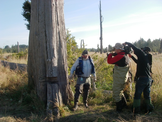
The ghostly tree trunks of once-submerged red cedars pictured in the July Image of the Month have played a key role in helping geologists reconstruct the events of the last Cascadia Subduction Zone (CSZ) magnitude 9 earthquake. As DGER chief hazards geologist, Tim Walsh, recently explained to a National Geographic television crew (see image below), the combined use of radiocarbon dating and tree ring analysis on these tree trunks allowed dendrochronologist David Yamaguchi (University of Washington) and geologist Brian Atwater (U.S. Geological Survey) to date an episode of sudden coastal subsidence that drowned the trees in seawater and killed them approximately 300 years ago (sometime between August 1699 and May 1700). This time frame also coincides with numerous accounts of a tsunami of unknown origin that reached Japanese shores on January 26, 1700. In The Orphan Tsunami of 1700 Atwater, Yamaguchi and their coauthors were able to correlate that tsunami with a CSZ megathrust earthquake that triggered the land subsidence and inundation event that submerged coastal forests in the Pacific Northwest. In relating the orphan tsunami to the subsidence event at the Copalis River pictured here, Kenji Satake (Geological Survey of Japan), Kelin Wang (Geological Survey of Canada), and Atwater reviewed the size, character and timing of tsunami waves along the Japanese coast and inferred that the wave train matched what would have been expected from a magnitude 9 Cascadia Subduction Zone earthquake. Their results were published in a Journal of Geophysical Research article in 2003.
In corroboration with the CSZ earthquake and tsunami theory, multiple records kept by Native American peoples of the Pacific Northwest also suggested violent shaking and flooding occurrences around that time. Ruth Ludwin (University of Washington) and others documented evidence found in Native Stories in a 2005 paper.

The earthquake of 1700 is the type of Cascadia megathrust earthquake we expect to reoccur in the Pacific Northwest at any time. It rivaled the magnitude and character of the Tohoku earthquake that devastated northern Japan on March 11, 2011. To Michael Polenz, the geologist who took these photographs, “it all adds up to a remarkable piece of geologic detective work, wherein coastal stratigraphic geology field work was combined with dendrochronology, ocean wave modeling, and historical research of municipal records on another continent to reveal the story of massive earthquakes here in Washington.”